Navigation
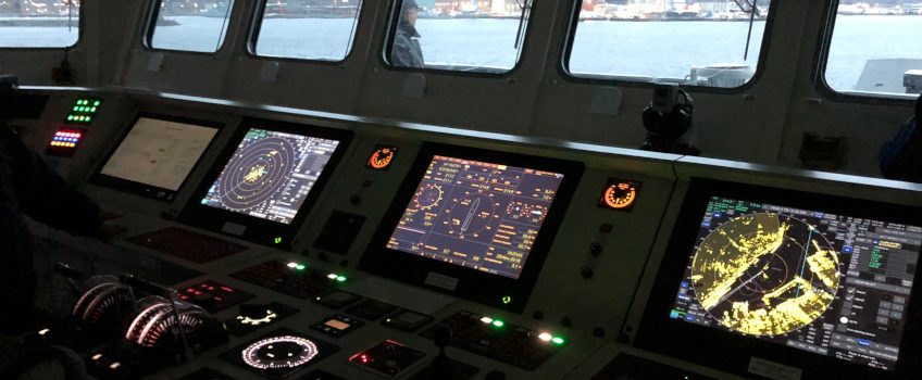
RADARpilot720°OS (Open Sea) is a sophisticated radar system suited for a variety of radar transceivers connected via network or analog interface. Due to the sampling frequency of up to 250 MHz, high resolution of the radar image is available. Radar enhancement, adaptive sensitivity control and sensitive time control (ASC, Auto STC), IR and advanced image processing based on OpenGL rendering, together with easily configurable blanking maps result in an excellent radar image, which automatically adjusts to changing weather conditions. Thereby, data load is reduced, while interruption free radar display is guaranteed, even during zooming. True trails and relative trails calculated in the background are available for display immediately on request.
On large ships, structures and cargo sometimes cause shaded areas on the radar image, so multiple radar scanners must be installed at the same time. With RADARpilot720° OS, we offer a certifiable open sea navigation system with the option to display several radar scanner. The overlay does not serve only for detailed display, but also as input for more reliable radar tracking. RADARpilot720° OS displays each radar image separately or as overlay of all radar images while layering can be changed. The user simply can switch to the display of interest or hide a specific radar image, enabling an unobstructed all-round view, and highly reliable and interruption free radar tracking.
further information
Seamless integration is feasible with existing network installations onboard. The software supports interfaces to other tracking systems (e.g. Combat Management System – CMS) as well as to Tracker and MultiSensorTracker of in-innovative navigation GmbH. Traffic scenarios and missions transmitted by a inVTS System are shown on the display, increasing the possibilities and range of application of radar beyond pure navigation.
Features
- PC based radar system
- Suited for a wide variety of radar scanners
(X-Band, S-Band, I-Band, E/F-Band, Pulse and Solid State Transceiver) - Open GL
- Chart display
- Transparent radar trails
- Highly reliable ARPA conform tracking, even without GNSS
- CPA/TCPA calculation
- AIS information
- Multi radar option, Multi radar tracking option
- Ergonomic operation, optional touchscreen
- Supporting Parallel Index lines
- Drawing and saving of maps
- Support of route functions
- Alarm server compatible with any hardware console (e.g. BAM)
- Easily extendible due to modular design and plug-in concept
- Platform independent


 Secure in Motion