Inform yourself on radapilot.de about our integrated navigation systems for inland and open sea and find out more about our ongoing research projects on the issue “digitization of shipping”.
Author: Claudia Dreller
Data communication at a new level
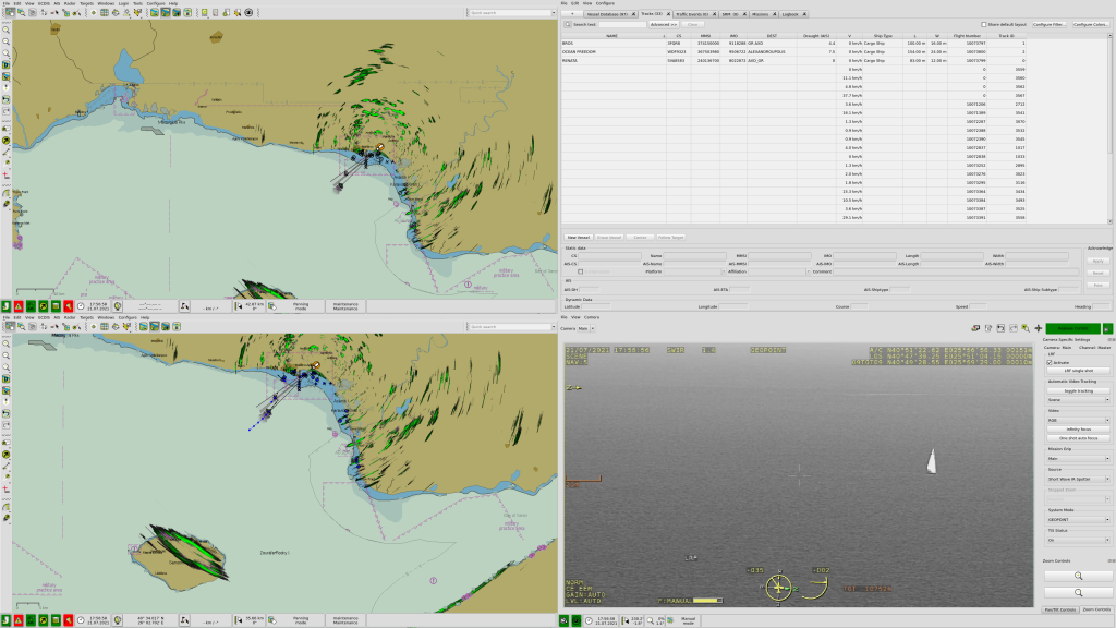
Inform yourself on the EUROPORT 2019 at booth no. 3303 about new possibilities of an extended display of the VTS traffic image. inVTS systems not only offer to display sensor data provided by sensors installed on mobile forces in a traffic control center; the data can also be shown in real time on mobile devices such as tablets using a standard web browser. This expands the range of options when using such data: Forces can inform themselves about the actual current situation regardless of their location.
How these new functions and the product portfolio of in-innovative navigation GmbH will be implemented in the nationwide traffic monitoring system in the Netherlands (LUV VTS NL) in the future will also be shown on at booth no. 3303 at the EUROPORT.
The in-innovative navigation GmbH can not only provide services for coastal and offshore monitoring, but also new technologies for inland navigation, as shown in the RADARpilot720 ° NG (New Generation). The combination with argoTrackPilot (argonics) gives the skipper a new assistance system that automatically guides a ship along a guiding line.
We are looking forward to your visit!
New National VTS system in the Netherlands will be delivered by in-innovative navigation GmbH
in-innovative navigation GmbH – together with its partner ENGIE – has been awarded this contract in May 2019 and the contract became effective on 3rd of June. The overall contract period is 10 years.
After a challenging technical qualification (Proof of Ability – PoA), which was organized and performed by RWS (Rijkswaterstaat) between 2016 and 2018, in-innovative navigation GmbH finally qualified for the submission of a commercial proposal to RWS. The project comprises the national, uniform and future-proof replacement of the radar target tracking system.
in-innovative navigation GmbH will provide software and services for the central processing of sensor data as well as display systems for 6 traffic centers across the Dutch waterways including coordination, management and maintenance.
in-innovative navigation GmbH has been awarded this contract in May 2019 and the contract became effective on 3rd of June. The overall contract period is 10 years.
Uwe Vögele, one of the CEOs of innovative navigation GmbH stated: “We are excited to play a significant role in the next generation VTS system for RWS with its innovative development towards corridor-oriented traffic management.”
Promising partnership for offshore solutions
The British company Nesspoint Ltd. and in-innovative navigation GmbH join their forces and cooperate in the field of vessel tracking management and sea surveillance for the offshore wind market. Nesspoint, formerly Vissim Renewables, in addition to its office base in Norwich now has a demonstration suite at the Orbis Energy Centre, the hub for offshore renewables. The company has been involved with delivery of technology to many wind parks around the United Kingdom. in-innovative navigation is industry leader for custom-developed software platforms for vessel traffic services.
Marcus Krol, Head of sales of in-innovative navigation GmbH, was especially delighted: “We congratulate Nesspoint to their impressive relaunch and are looking forward to work with them. From my point of view, the partnership between the two companies will be an ideal match. We complement each other perfectly with respect to technology as well as to geography. Together we are able to provide the all-round solution for offshore facility surveillance and organization, and concurrently we will open up new sales fields for each other.”
New VTS for Sassnitz/Mukran Harbor on the island of Rügen
The city of Sassnitz has commissioned in-innovative navigation GmbH to deliver and install the new Vessel Traffic Service system for the ports of Sassnitz and Mukran on the island of Rügen. For the first time, in-innovative navigation GmbH has offered the option to deliver the system as a leasing model. Initially, the contract runs for 5 years after commissioning.
The inVTS will combine the monitoring of the Sassnitz port and Mukran Port, thus, enabling central traffic management. The system includes a new radar scanner, radar video network and multi-sensor tracking, as well as processing AIS data and integration of several cameras distributed in the ports of Sassnitz and Mukran. In addition, data of wind, barometric measurements and other weather sensors are integrated. A central, fixed VTS workstation in the port of Sassnitz will display all information, but also mobile web-based displays are made available to further users.
While the Sassnitz city harbor has established itself as a mixture of fishing and tourism port, Mukran Port is a multipurpose port with direct access to the open Baltic Sea, which leads to its steadily increasing importance. Its geographical position close to Sweden, Denmark, Finland, Russia and the Baltic states makes the site predestined as a major hub for international passenger and freight traffic.
Additionally, due to the facilities provided on 430 hectare and the well established transport connections to the hinterland, the port offers ideal conditions for serving the growing offshore wind industry.
“The contract for the modernization of the VTS has been signed on June 6th,“ Gero Diezis, senior sales engineer in-innovative navigation GmbH, explains: “I am sure that our system will meet all requirements at the harbor authorities’ utmost satisfaction. We are very happy that we could win another important German port as customer besides Port of Hamburg. The Sassnitz/Mukran Port is becoming one of the major industrial and commercial centers at the German Baltic Sea. This is the testimony for our modular solutions approved. In addition, the new leasing model we were able to offer is of benefit for both sides. “
MI 2019, Booth C.130: further steps towards digitized navigation
At this year’s MARITIME INDUSTRY in Gorinchem, 07.-09. May, we will be presenting the current version 4.6 of the navigation system RADARpilot720° at booth C.130.
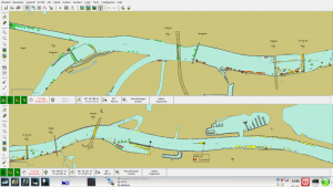
The combination of RADARpilot720° with argoTrackPilot gives the skipper a new assistance system that automatically guides a ship along a guiding line. Based on guiding lines provided by RADARpilot720°, the argoTrackPilot generates according steering commands for the on-board autopilot. The helmsman can move the current guiding line and the ship automatically follows. The navigation display, RADARpilot720° displays the currently set and saved lines, along with all data from the radar, chart and AIS. This allows the skipper to see all the necessary information at a glance.
Furthermore, with RADARpilot720°, version 4.6, now a system update can be done, which does not require shipping CD’s. Using a mobile internet connection, existing charts and the RADARpilot720° software can be synchronized with a server. Up-to-date charts are installed quickly and easily on the system. At the same time, there are also improved options for remote maintenance via the Internet.
New, precise sensor solutions, we will also present at the MARITIME INDUSTRY. Powerful GNSS receivers reach accuracies of 10 cm for position and of 0.1 degrees for the heading value. Thus, the electronic chart display can also be used when naviagting a large ship during mooring or at a lock entrance.
Convince yourself of the latest maneuvering options at booth no C.130; a joint stand of in-innovative navigaton GmbH and argonics GmbH!
Development and implementation of a modern Inland AIS system for the Donau River Information Service (DoRIS)
As part of the modernization of inland AIS communication on European inland waterways, the proven Austrian information and management system DoRIS (Donau River Information Service) will be extended. It has been operated by the viadonau since 2005 and serves both skippers and logistics providers, as well as authorities and the administration of the waterway as an important source of information about the traffic situation, water levels and lock waiting times. DoRIS prepares all information in a user-friendly way and makes it available via web portals, e-mail or as mobile apps.
viadonau has now awarded the contract to in-innovative navigation GmbH for renewal of this system with extension of the functionality scope. The new software is adapted to state-of-the-art technology and will meet the requirements of the international standardization panels. All data will not only be available at workstations in the traffic control center, but the data will also be presented via web technology on mobile devices.
Uwe Vögele, CEO of in-innovative navigation GmbH, confirms: “That was good news that just came right for Christmas. We are very proud that viadonau wants to carry on working with us for this forward-looking project in the area of Inland AIS. Thus, we can continue this exchange of experience, which was very fruitful for both parties in the past. “.
Start signal for the development of SciPPPer – an innovative locking assistant
The name SciPPPer (SChleusenassistenzsystem basierend auf PPP und VDES für die BinnenschifffahRt) stands for “Inland Locking assistance navigation system based on PPP and VDES“). Within SciPPPer which is funded by the Federal Ministry for Economic Affairs and Energy (BMWI), in-innovative navigation GmbH is one of seven project partners involved in improving the technology standard of the waterway infrastructure in Europe, since the enhancement of inland and coastal shipping is a necessary auxiliary measure to improve efficiency of logistics.
Lock passages are of the most common, but also the most demanding and critical inland waterway maneuvers and they take a considerable amount of travel time. The aim of the project for in-innovative navigation GmbH is the development of an innovative assistance system, which will ultimately allow automatization of entering and leaving a lock.
One of the CEOs of in-innovative navigation GmbH, Dr. Martin Sandler, explains: “Technically, the real time and highly accurate positioning of the ship bases on satellite navigation and precise distance measurements. The new technology PPP (Precise Point Positioning) provides these data. Transmission is using the new VDE (VHF Data Exchange) standard. We will develop the integration of the information and presentation on a corresponding navigation display. Further we research the required short-range sensor technology within the framework of the project.”
To secure and expand Germany’s position as a logistics hub in Europe, the inland waterway as part of the transport chain can be integrated more efficiently. Therefore, the effective use of waterways and locks is an important approach.
EU’s Project RIS COMEX for seamless integration of River Information Services
Improved information flow along inland waterways, also across intra-European borders, is intended to increase the efficiency of waterborne transportation and logistics throughout Europe. To implement these plans, thirteen countries have decided to jointly conduct the research project RIS COMEX (River Information Services COrridor Management EXecution).
As part of RIS COMEX, which is coordinated by the Austrian viadonau and runs over 4 years, the infrastructure of the existing AIS services will be expanded, and the Inland AIS Standard of the future will be defined to be able to transmit further data from ship to ship and land to ship.
The additional AIS messages are intended to inform the helmsmen timely about current water levels, lock waiting times, bridge clearance or temporary construction work and any resulting impairments. Further, more AtoNs (AtoN = Aid to Navigation) shall be used in the future. AtoNs are real stationary traffic signs and tons, which are also shown in maps. Those traffic signs will obtain a sending transponder. Thus, a navigation system aboard the ship can display the real actual position and current state immediately and correct.
In addition, a nautical officer can set AtoNs temporarily and transmit their virtual position to the on-board computers of the vessels, in order to warn the skippers of shallows or an average from the traffic control center and to mark the safe route.
Dr. Thomas Gern, CEO of in-innovative navigation GmbH, reports: “Inland ECDIS chart display and Inland AIS transponder, both are mandatory equipment in commercial inland shipping for several years now. in-innovative navigation GmbH is one of the well-known companies that manufactures such integrated navigation systems, and we will investigate together, how the new information should be presented in a meaningful and reliable way on the board computer. At the same time, test corridors will be set up at various European waterways to expand the current AIS network. We are proud to report, that RIS COMEX has commissioned our company with the research work for the vessel equipment and also to provide the German AIS-infrastructure necessary on land. The new functions can be tested and presented along these river sections. On the basis of the results, the European RIS Expert Groups will be able to develop the new standard for inland AIS communication.”
Renewal of the VTS at Port Mohammedia, Morrocco
The port surveillance with radar and AIS at Mohammedia, Morocco, was installed in February 2012 as security solution provided by the company INDRA. The system is used to surveil the traffic at the oil refinery port of Morocco and included 1 radar location and AIS. To display the radar information correctly in the service room and in the control center, software components of in-innovative navigation GmbH came into operation.
Now, INDRA ordered a hardware upgrade as well as newer versions of the software RADARserver and RADARextracktor/tracker, which also includes a state-of-the-art PCI-Express RADARinterface card and, therefore, achieves better performance.
“Our modular concept allows the seamless integration of the new soft- and hardware with the existing modules like MST (MultiSensorTracker) and RADARgrabber. This shows the advantage of this system setup. Maintenance and renewal of parts of the system are possible without interruption. The longstanding cooperation with INDRA and the end customer shows how stable our VTS systems work.” project manager Sebastian Wagner of in-innovative navigation GmbH says.
STL 2018: SECURE in MOTION – little aids for navigation
At this year’s SHIPPING TECHNICS LOGISTICS (STL) in Kalkar, on the 25th and 26th September, in-innovative navigation GmbH will present new support functions for navigation at booth 140 of its distribution partner Engel & Meier:
The combination of the integrated navigation system RADARpilot720° with the automatic track control system argoTrackPilot. The argoTrackPilot generates positioning commands derived from a guiding line and transmits them to the on-board autopilot. The guiding lines shown by RADARpilot720° are determined by the skipper. Thereby, dynamics and special characteristics of the ship are taken into account for the automatic track control.
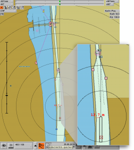
Furthermore, you will discover the possibilities of today’s GNSS technology: A modern high-performance GNSS receiver makes possible accuracies of 10 cm for the position measurement, and 0.1 degrees for the heading information. These precise navigational data allow the exact representation of the own vessel on the navigation display RADARpilot720°, e.g. during mooring or when entering a lock. The position accuracy is made possible by special correction data received over a mobile internet connection. Rule lines for locks shown in the display of RADARpilot720° additionally support the skipper. Let us convince you: Such little helpers take safety in navigation to a new level!
Display of rule lines at locks in the chart of RADARpilot720°:
Meet us at the SMM 2018, Hamburg!
The customized inVTS Solutions of in-innovative navigation GmbH are in operation for lock organization, in port management systems and maritime monitoring systems, e.g. for protection of offshore wind farms, but also as complete coastal surveillance systems. Hamburg Port Authority (HPA) itself relies upon our hardware and software components for surveillance of Germany’s biggest seaport.
Inform yourself about our newest high-tech software modules and try out the comfortable display system inDTS, as well as the flexible web based display application inWebDTS , which provides a traffic viewport based not only on AIS information but also provides a radar image. Integration of CCTV- data and satellite pictures are further options available.
At booth no 404 hall B6 you can also find a presentation of the integrated on-board navigation systems RADARpilot720° and RADARpilot720° OS meeting highest requirements for use on inland waterways and on high seas.
Furthermore, the company in-innovative navigation GmbH will present results of the research project “Guidance and assistance systems for increasing the safety of navigation on inland waterways” (LAESSI) at SMM on the booth no 142 of DLR, also in hall B6. There, you will find out about new possibilities to support and warn the skipper during difficult maneuvers and passages of bridges.
inVNE – Simulator with new functions
Since 2005, the inVNE simulation environment and the radar simulator (RaSi) of in-innovative navigation GmbH have been successfully operating in the German Water Police Academy (WSPS) in Hamburg providing schooling for all officers of the Water Police throughout Germany. The future skippers are trained on virtual bridges for radar navigation on coastal and inland waterways. The simulation system is regularly enhanced and updated by in-innovative navigation GmbH and adapted to current technologies. At the beginning of July this year, the most recent modernization for the system architecture was presented and passed the Factory Acceptance Test (FAT) by the WSPS.
Simultaneously with the hardware upgrade, the software for controlling the exercises will be fundamentally renewed. The so-called supervisor interface of the trainers then combines all functions for preparation (creating, editing exercises …), planning, execution and evaluation of training sessions. Furthermore, a running simulation can be switched to freeze mode at any time to allow a briefing or an immediate analysis of a training situation. In contrast to a normal simulation pause, all radars and display systems continue to be supplied with data in freeze mode, so that disturbing error messages are avoided.
New interactive controls, e.g. setting course and speed or as well as dynamic waypoints for a simulated ship, enable a quick adjustment of scenarios while the exercise is in progress.
Proven and user-friendly features that make RaSi so unique among radar simulators, such as the highly realistic radar generation, cooperative training and live AIS feed have also been enhanced and improved.
The implementation of the modernized system is planned for the month of August during vacation time of the busy school.
ISO certification passed successfully
The in-innovative navigation GmbH has successfully completed the recertification according to the new standard DIN EN ISO 9001 : 2015, and thus, fulfills the requirements of this standard in the area of development, production, sales and distribution of components and systems for navigation, traffic surveillance and traffic management without any deviations.
Probably the most important progress compared to the last audit was the implementation of processes for structured management of risks and opportunities.
The re-certification after independent examination shows that in-innovative navigation GmbH
serves customers with high quality and will do so in future.
Navigational safety by recommended corridors
in-innovative navigation GmbH has been commissioned as one of 5 partners for the project HANSA, which is supported by MarTERA and funded by the Federal Ministry for Economic Affairs and Energy.
The aim of the project is to determine the safest route for each type of ship under different weather conditions and tidal currents by retrospective analysis of a huge amount of historical AIS data. This will provide masters with valuable information in advance about areas of heavy marine traffic such as the North Sea or the Eastern Chinese Sea. The risk of collisions and groundings, which are not uncommon in these busy areas, will thus be mitigated.
The various routes theoretically available on a waterway are weighted against each other using the existing data and appropriate algorithms, taking into account vessel characteristics and ship types, as well as any other maritime data.
Thus, HANSA provides a novel approach to use historic information to validate planned routes and actual voyages. “Recommended Routing Corridors” enable the mariner on board and operators ashore to detect potentially hazardous situations for the own vessel or the general traffic situation earlier in the planning or monitoring phase.
The project duration is 24 months. The consortium joins partners with different fields of expertise in big data analysis, marine research, communication technology, simulation and logistics: OFFIS e.V., PUEB of the University of Poznan, in-innovative navigation GmbH, NAVTOR and SPRINT.
Visit us at booth no. C.126!
At this year’s MARITIME INDUSTRY (May 29th -31th) in Gorinchem, in addition to new assistance systems that support the skipper during docking, entering a lock or passing a bridge, we will also show the combination of the integrated navigation system RADARpilot720° with the guidance system argoTrackPilot. This combination represents a new class of ship control. We are looking forward to your visit!
Impressive final presentation of the collaborative research project LAESSI
On March 22, 2018, the official closing demonstration of the joint project “Guidance and assistance systems for increasing the safety of navigation on inland waterways” (LAESSI) took place in Würzburg. At the event, representatives from shipping authorities and media representatives were able to witness live on the vessel MS Jenny, as the new assistance systems were demonstrated.
In recent years, inland vessels have become longer, wider and thus heavier. Furthermore, the goods transported changed from dry goods, as coal and ore, to containers. The result is heavier traffic and increasingly complex logistics. In the joint project LAESSI, the four project partners (in-innovative navigation GmbH, WSV, DLR and Alberding GmbH) developed a system with new assistance functions for the ship’s command. In the future, they should reduce the risk of collision and make barges safer.
Basic technology for this purpose is the highly accurate and reliable satellite-based determination of position, height and heading of a ship as well as the provision of up-to-date information about the waterways (e.g., blockings, restrictions, work on bridges, etc.).
In the project, four support systems have been developed:
- The bridge collision warning system alerts the skipper as soon as there is a problem with the bridge crossing.
- The mooring assistant displays the measured and calculated distances to the quay wall or to other ships, thus, assisting the skipper in demanding maneuvers.
- The automatic track control relieves the skipper of the trip by keeping the ship on a previously defined route.
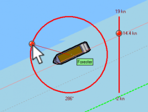
- The conning indicator permanently displays all movements of the ship, the rudder position and the speed of the propeller.
About the project:
In the joint project, partners from industry, science and the federal government worked together. It was funded by the Federal Ministry for Economic Affairs and Energy (BMWi) as part of the Next Generation Maritime Technologies program and ended after two and a half years with the successful demonstration of the new technology.
GoTo LAESSI Info Movie
in-innovative navigation GmbH is partner of the consortium NOVIMAR
The aim of the NOVIMAR project is to optimize the transport of goods on waterways. It started in June 2017 with a first meeting of the project partners. In addition to in-innovative navigation GmbH, 21 other partners from 9 European countries are involved in the consortium, including logistics experts, representatives from industry and various public institutions as well as research institutes. Together, the possibilities and costs / benefits of a new transport system, the so-called Vessel Train, are researched and evaluated.
The vessel train consists of one crewed leader vessel followed by a number of lowly manned or unmanned follower vessels from different class sizes. The follower vessels keep their own manoeuvring capabilities, but will partly under automatic control and mostly be led by the crewed leader vessel. NOVIMAR will identify needed boundary conditions for such a transport system which would be more economical and offers more flexibility and efficiency in terms of logistics.
“As the leading European manufacturer for integrated Inland-ECDIS navigation systems, we believe that future developments will raise the level of automation and autonomy of ship guidance similar to the development in automobiles. Within NOVIMAR we want to contribute our knowledge and experience already at a research level to make navigation easier and safer.” says Sebastian Wagner, project manager at in-innovative navigation GmbH.
Further information about the future project is available at www.novimar.eu .
Green light for development of NaMIB
In 2017, innovative navigation was contracted by KISTERS AG, respective WSV (Waterways and Shipping Authority, Koblenz) as end customer, with the development and implementation of a software system that is modular and applicable on a nationwide basis. I will be the follow up application (NaMIB – Nachfolgeanwendung des bestehenden Melde- und Informationssystems für die Binnenschifffahrt) to the already existing reporting and information system of the WSV.
WSV’s inland navigation, reporting and information system (MIB I/ II+), which has been in operation since 2010, serves to provide the relevant service and rescue teams with information pertinent to their operation in case of emergencies, accidents or maritime damages. Certain ships are obligated to register and unregister when passing the major inland waterways. Simultaneously, the responsible VTS centers inform the skippers about the state of the according waterways. Thus, ship, cargo and/or voyage data can be quickly provided and forwarded in case of an incident and, thereby, enabling the appropriate measures to be taken faster.
in-innovative navigation GmbH gave the go-ahead for the development of the follow-up system, after the fine specification had been accepted and the critical design review passed.
By December 2018, 10 operational units of the WSV in Germany as well as additional locations in the neighboring countries (CH, FR, and LU) will be equipped with the new soft- and hardware replacing the former system, and, thus, enabling Germany to fulfill, to a greater extent, the current European requirements for the harmonization of the inland navigation information services (RIS). As a result, inland navigation will be a step safer, more efficient and more environmentally friendly.
Automatic track control with RADARpilot720°
Guiding lines have been an approved component of the integrated navigation system RADARpilot720°, and have to date acted as optical provisions for the ship’s route on the waterway. They predominantly consist of curves that adapt themselves to the naturally curved river.
In combination with the argoTrackPilot, a new system has now being created to automatically guide a ship along this line. The argoTrackPilot generates coordinated control-commands for the on-board autopilot. Thereby, it takes into account the specific features of the vessel. It is additionally possible to move the current travel track parallel to the saved track, if the current situation calls for it. The ship then automatically pivots on the new line, without having to switch off the track control.
The RADARpilot720° displays the currently set as well as the saved track on its navigation display. It is presented together with chart, radar and AIS information. As a result, the skipper has all the required information on one screen.
The ship’s captain can then easily choose the appropriate guiding line from a selection, quickly adjust existing lines directly on the display, as well as create and save new guidelines.